旅行
账户
Violette54
A Beautiful, Sunny and Clear day.
冰川湾的点评
点评:President Calvin Coolidge declared ‘Glacial Bay’ to be a National Monument in February 1925. His intent was that all that natural beauty should be preserved for future generations. Today’s Glacier Bay is roughly the size of Connecticut with 1,375 sq. mls. of alpine glaciers, which account for more than ¼ of the park area, with most glaciers originating in mountains with elevation ranges of 8,000–15,000 ft.
250 years ago, Glacier Bay was a massive river of ice, estimated to be 100 miles long and thousands of feet deep. 1850 saw 150 glaciers. By 2022, that number decreased to 25 active glaciers. Today, our cruise ship took us 65 miles up the bay to reach our first visible tidewater glacier. Current predictions say that by 2030 the glaciers we are seeing now will no longer be visible.
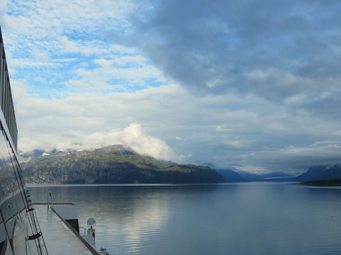
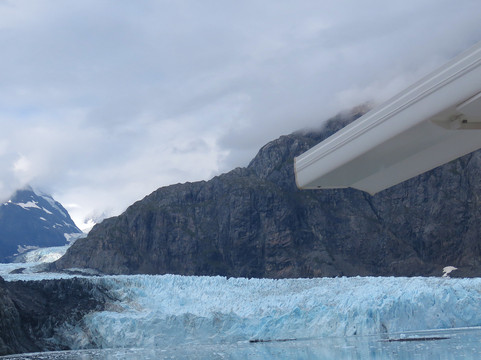
#104c Against the ship’s side entering Glacier Bay.
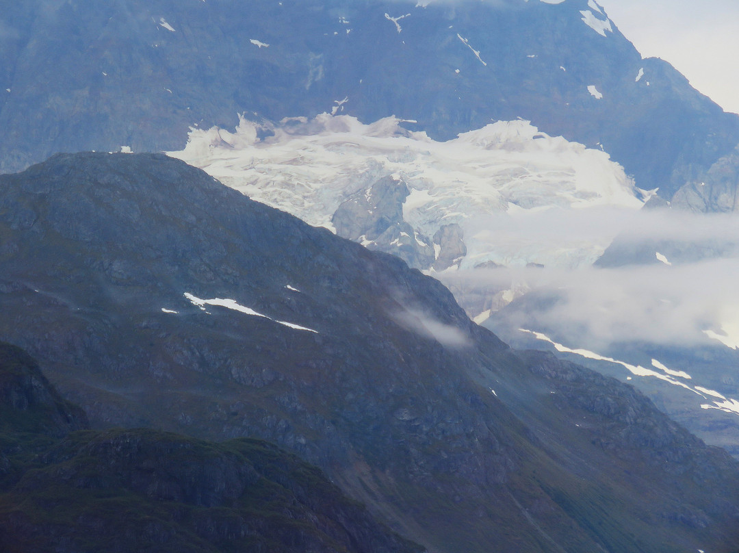
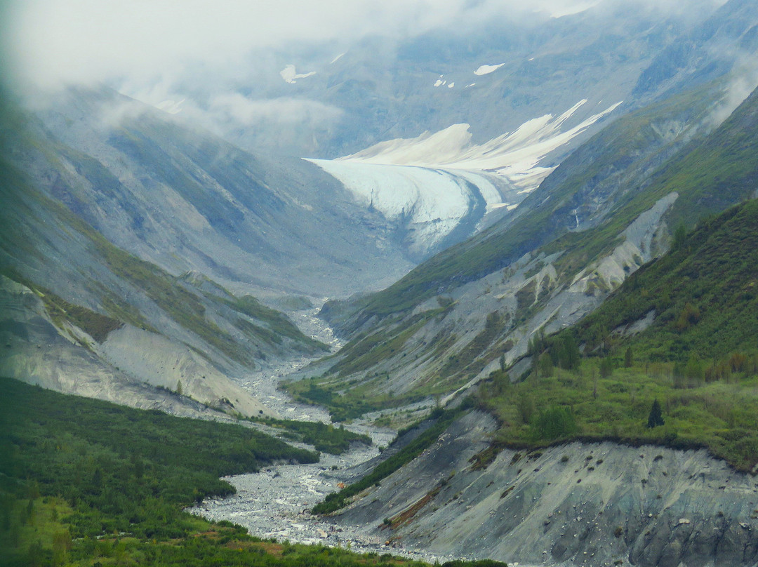
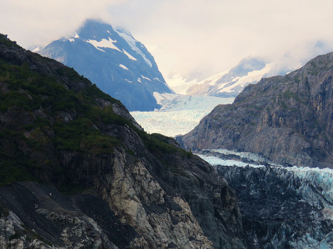
#105c Close-up of a Glacial Cirque, where glaciers are formed.
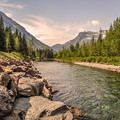
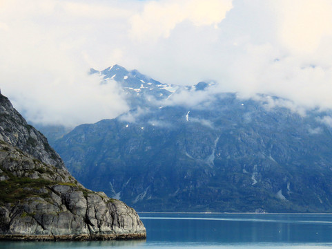
#106 Green coastline S. of Russell Island
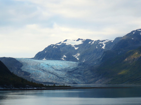
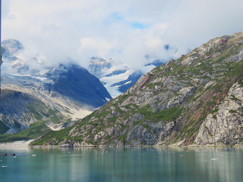
#107 Reid Glacier is 11-miles-long, ¾ mile wide and 150 ft. high. Its
partly terrestrial and partly tidewater.
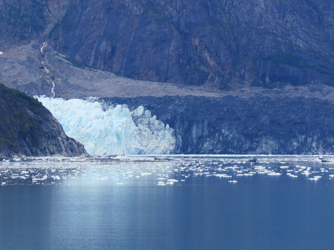
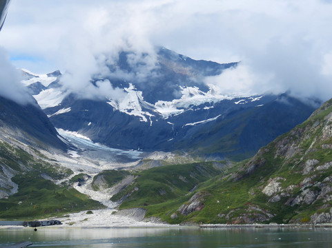
# 108, b, c, Lamplugh Glacier is 8—miles long, 0.9 miles wide, 165 feet
high at the face, and over 19 miles long. Its flow rate is
approximately 0.75 —1 foot per day. It’s noted for the intense
blue color of its ice.
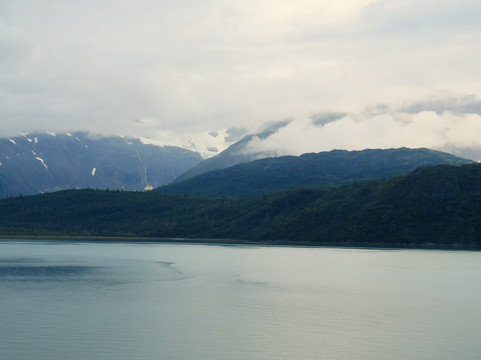
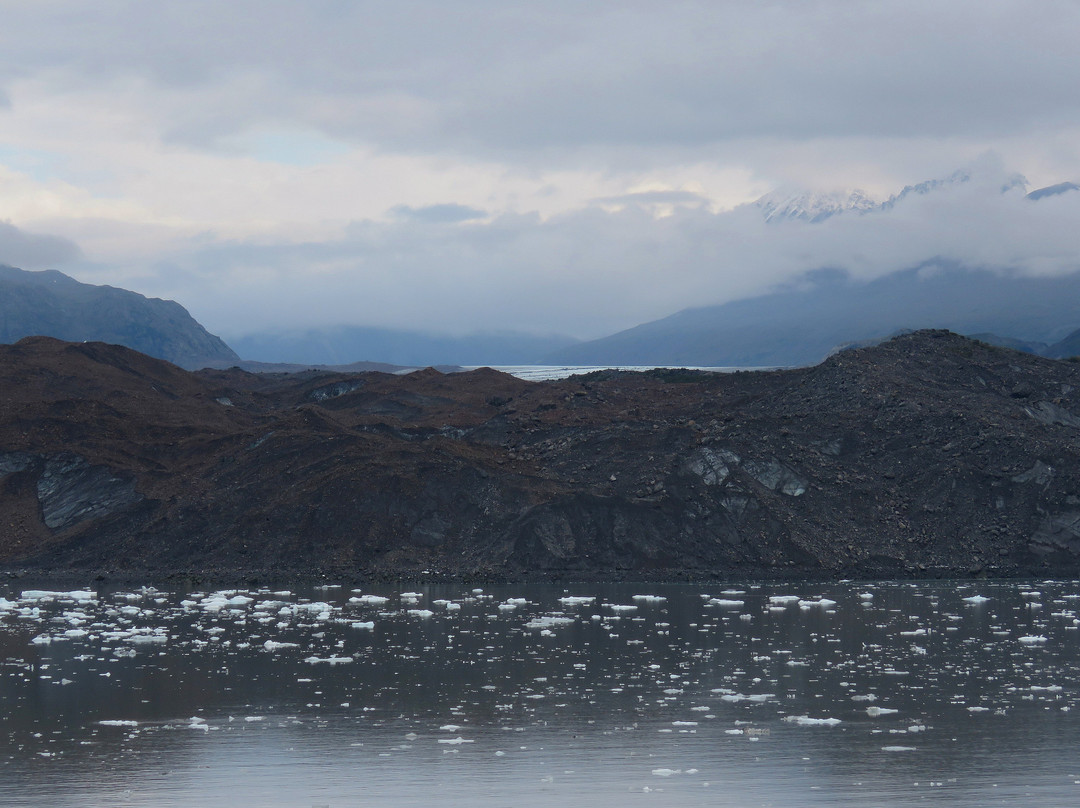
#109 Grand Pacific Glacier. This glacier is credited with carving
Glacier Bay. In the past 250 years it has receded to the head
of Tarr Inlet, where the terminus is no longer tidewater. What
we see now is the moraine cap stone. Its 16-miles-long.
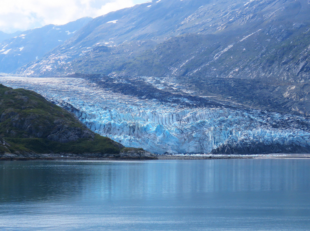
#110, b, Margerie Glacier is found at the furthest north end of Tarr
Inlet. Margerie is a ‘cleaner’ glacier because it churns up the
embedded rock in to fine pieces; tidewater, because it flows
directly into the sea. It’s 21 miles long and moves relatively
quickly.
#111 Captain opened the Forward Deck for viewing.
#112 Johns Hopkins Glacier is found at the end of the Inlet of the
same name. It was the show piece of this trip, on a rare and
beautifully clear and sunny day. It’s 1 mile wide, and stands
250 feet above the water line. It also extends well into the sea
bed, protecting its underwater sea ice with a wall of
underwater moraine. It also has
‘stripes’; lateral moraine ice runs the length of the glacier.
Mounts Orville and Wilbur named for the Wright brothers, are
behind it. It is an advancing tidewater Glacier.
#112c is a similar photo, only with another large cruise ship on the
left. I appreciated the size comparison.
114, 114b Gloomy Knob is a mostly barren rock, composed of
dolomite which formed underwater in tropical regions.
Tectonic movement brought it to its present location.
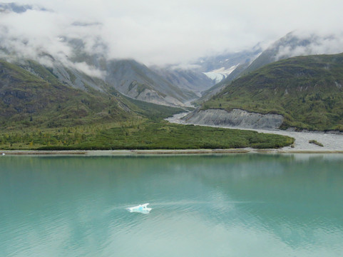
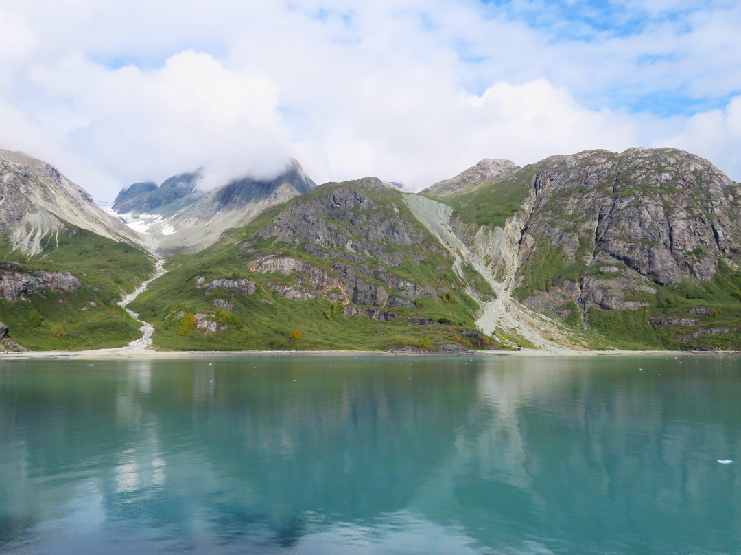
115 115b Shoreline along Russel Island and b, with a glacial melt
stream.
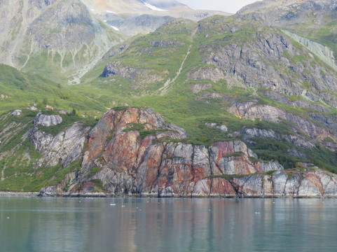
116 Contrasting Colored rocks; beautiful against the green
water.
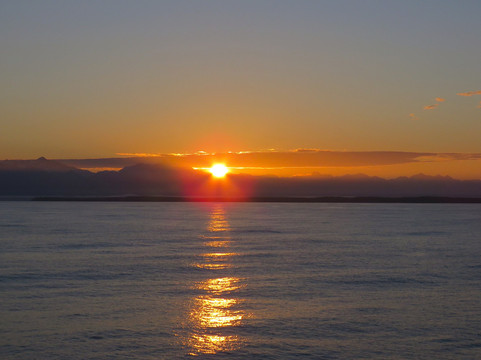
117 Sunset at Sea
250 years ago, Glacier Bay was a massive river of ice, estimated to be 100 miles long and thousands of feet deep. 1850 saw 150 glaciers. By 2022, that number decreased to 25 active glaciers. Today, our cruise ship took us 65 miles up the bay to reach our first visible tidewater glacier. Current predictions say that by 2030 the glaciers we are seeing now will no longer be visible.
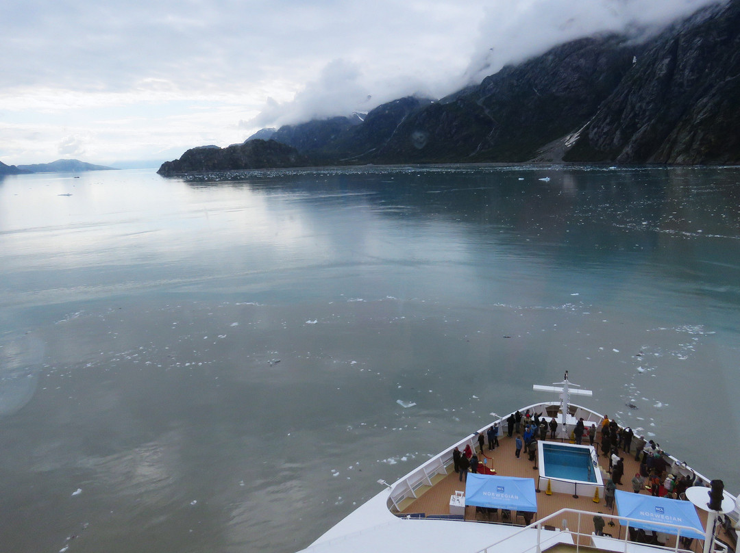
#104c Against the ship’s side entering Glacier Bay.
#105c Close-up of a Glacial Cirque, where glaciers are formed.
#106 Green coastline S. of Russell Island
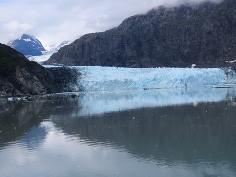
#107 Reid Glacier is 11-miles-long, ¾ mile wide and 150 ft. high. Its
partly terrestrial and partly tidewater.
# 108, b, c, Lamplugh Glacier is 8—miles long, 0.9 miles wide, 165 feet
high at the face, and over 19 miles long. Its flow rate is
approximately 0.75 —1 foot per day. It’s noted for the intense
blue color of its ice.
#109 Grand Pacific Glacier. This glacier is credited with carving
Glacier Bay. In the past 250 years it has receded to the head
of Tarr Inlet, where the terminus is no longer tidewater. What
we see now is the moraine cap stone. Its 16-miles-long.
#110, b, Margerie Glacier is found at the furthest north end of Tarr
Inlet. Margerie is a ‘cleaner’ glacier because it churns up the
embedded rock in to fine pieces; tidewater, because it flows
directly into the sea. It’s 21 miles long and moves relatively
quickly.
#111 Captain opened the Forward Deck for viewing.
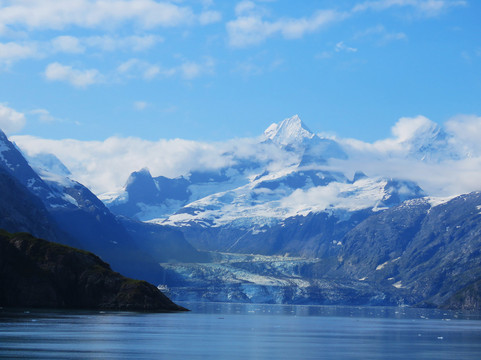
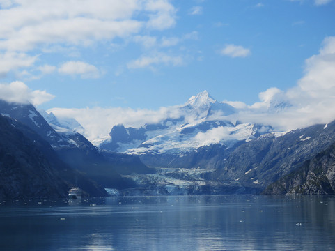
#112 Johns Hopkins Glacier is found at the end of the Inlet of the
same name. It was the show piece of this trip, on a rare and
beautifully clear and sunny day. It’s 1 mile wide, and stands
250 feet above the water line. It also extends well into the sea
bed, protecting its underwater sea ice with a wall of
underwater moraine. It also has
‘stripes’; lateral moraine ice runs the length of the glacier.
Mounts Orville and Wilbur named for the Wright brothers, are
behind it. It is an advancing tidewater Glacier.
#112c is a similar photo, only with another large cruise ship on the
left. I appreciated the size comparison.
114, 114b Gloomy Knob is a mostly barren rock, composed of
dolomite which formed underwater in tropical regions.
Tectonic movement brought it to its present location.
115 115b Shoreline along Russel Island and b, with a glacial melt
stream.
116 Contrasting Colored rocks; beautiful against the green
water.
117 Sunset at Sea
翻译:1925 年 2 月,卡尔文·柯立芝总统宣布“冰川湾”为国家纪念碑。他的意图是,所有自然美景都应该为子孙后代保留下来。如今的冰川湾面积与康涅狄格州相当,拥有 1,375 平方英里的高山冰川,占公园面积的四分之一以上,大多数冰川起源于海拔 8,000-15,000 英尺的山脉。
250 年前,冰川湾是一条巨大的冰河,估计长 100 英里,深数千英尺。1850 年有 150 座冰川。到 2022 年,这个数字下降到 25 座活跃冰川。今天,我们的游轮载着我们沿着海湾向上游 65 英里,到达了我们第一个可见的潮水冰川。目前的预测表明,到 2030 年,我们现在看到的冰川将不再可见。
#104c 靠在船的侧面进入冰川湾。
#105c 冰川形成的地方,冰川的冰斗特写。
#106 拉塞尔岛南部的绿色海岸线
#107 里德冰川长 11 英里,宽 ¾ 英里,高 150 英尺。它的一部分是陆地,一部分是潮水。
#108,b,c,兰普卢冰川长 8 英里,宽 0.9 英里,表面高 165 英尺,长度超过 19 英里。它的流速约为每天 0.75-1 英尺。它以冰的深蓝色而闻名。
#109 大太平洋冰川。这座冰川被认为雕刻了冰川湾。在过去的 250 年里,它已经退缩到塔尔湾的源头,那里的终点不再是潮水。我们现在看到的是冰碛盖石。它有 16 英里长。
#110,b,玛格丽冰川位于塔尔湾最北端。玛格丽是一座“更干净”的冰川,因为它将嵌入的岩石搅成细小的碎片;潮水,因为它直接流入大海。它长 21 英里,移动速度相对较快。
#111 船长打开前甲板供参观。
#112 约翰霍普金斯冰川位于同名海湾的尽头。这是这次旅行的亮点,在一个罕见而晴朗的阳光明媚的日子。它有 1 英里宽,高出水面 250 英尺。它还延伸到海床深处,用一堵水下冰碛墙保护着它的水下海冰。它还有“条纹”;侧冰碛沿着冰川的长度延伸。以莱特兄弟命名的奥维尔山和威尔伯山就在它后面。这是一个前进的潮水冰川。#112c 是一张类似的照片,只是左边还有另一艘大型游轮。我很欣赏这种大小比较。114,114b Gloomy Knob 是一块大部分是贫瘠的岩石,由热带地区水下形成的白云石组成。构造运动把它带到了现在的位置。115 115b 拉塞尔岛沿岸的海岸线和 b,有一条冰川融水流。116 对比色的岩石;在绿水的映衬下美丽极了。117 海上日落

© 2025 Tripadvisor 版权所有。
部分照片由 VFM Leonardo 提供。
TripAdvisor公司对外部网站的内容一概不负责。优惠价格中不含税和其他费用。
ICP证:沪B2-20200433
沪ICP备20013175号
 沪公网安备31010502005427号
鹰程信息技术(上海)有限公司