旅行
账户
westy54
Highest point on the Island. Summit Track from Mt Pitt not that easy a walk.
Mount Bates的点评
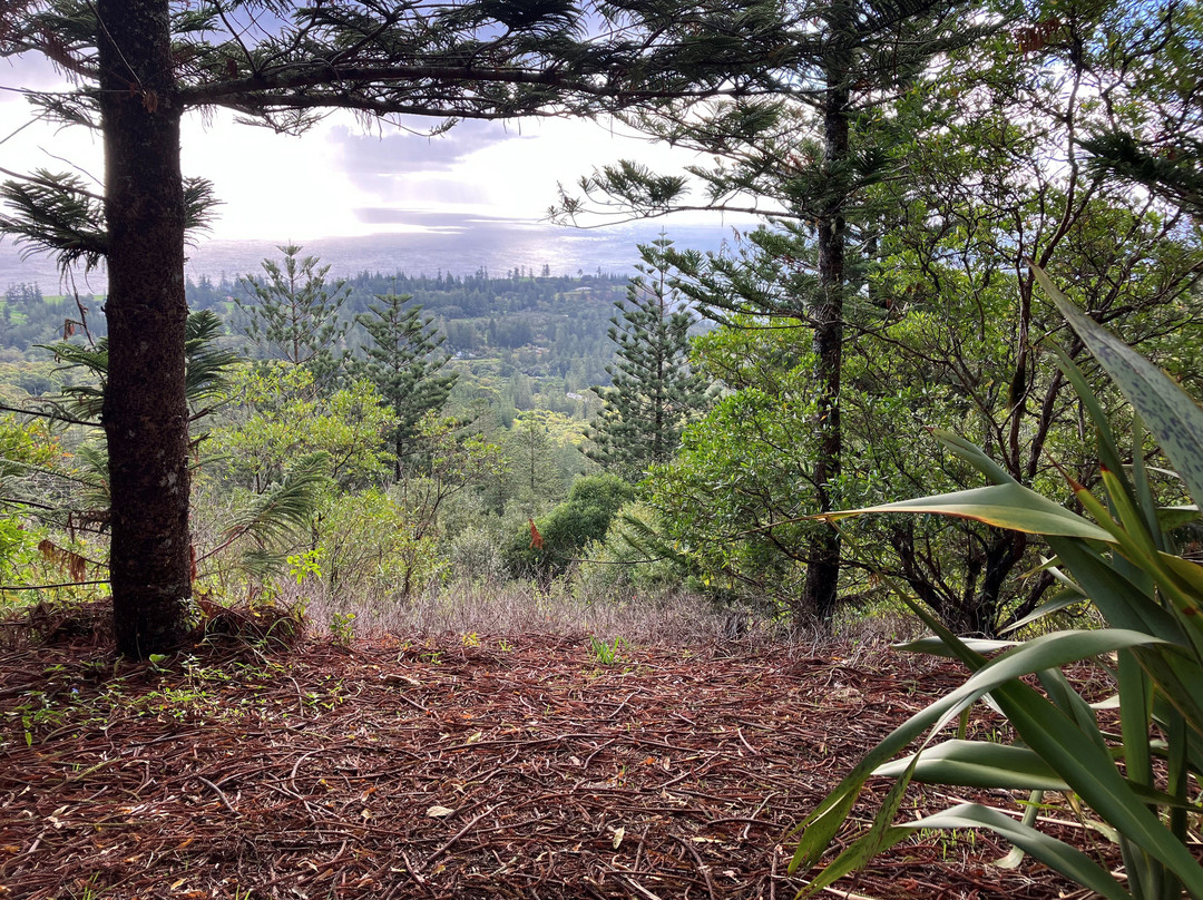
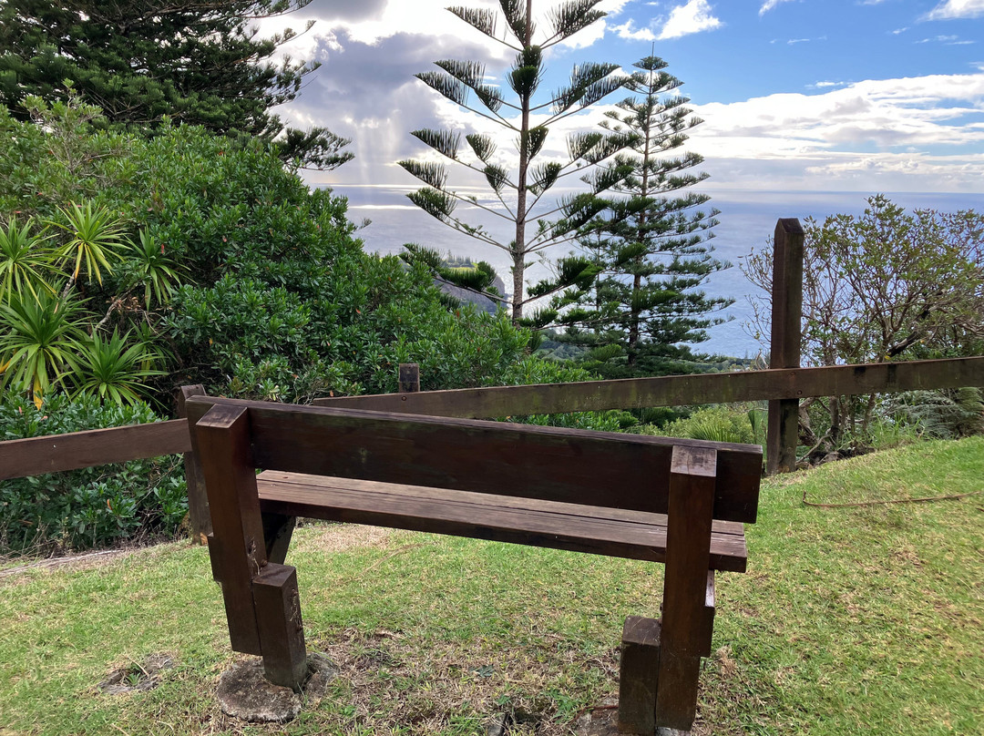
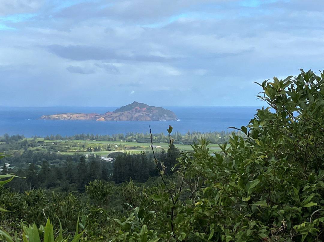
点评:Mount Bates may be the highest point on the Island, at 319 metres above sea level - a metre higher than Mount Pitt - but the views are better from Mount Pitt.
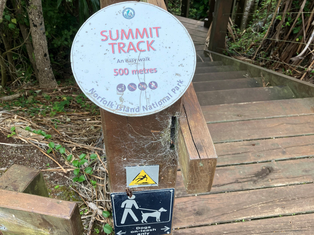
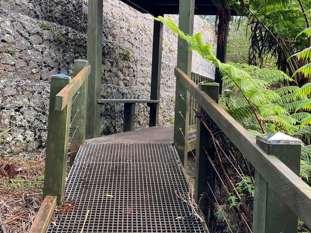
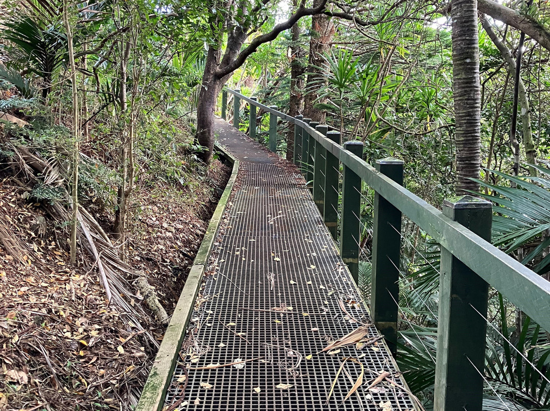
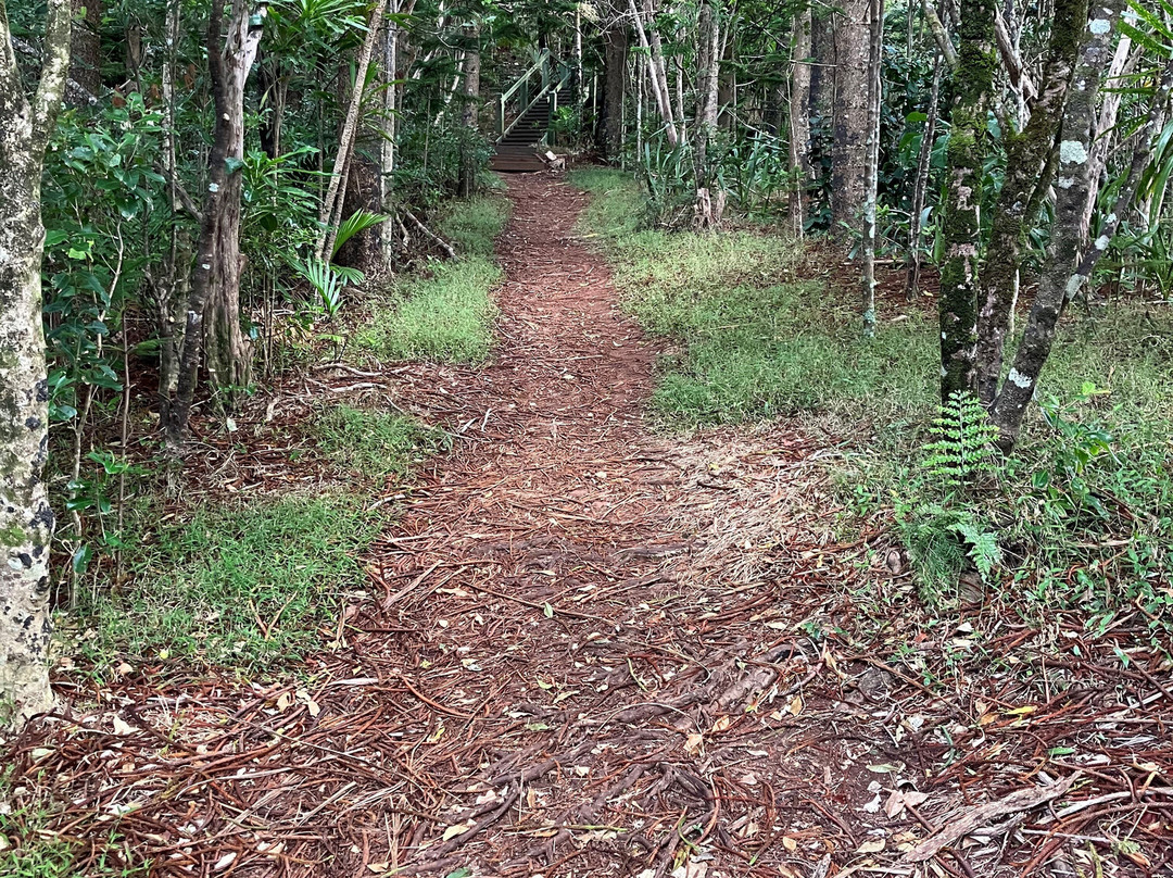
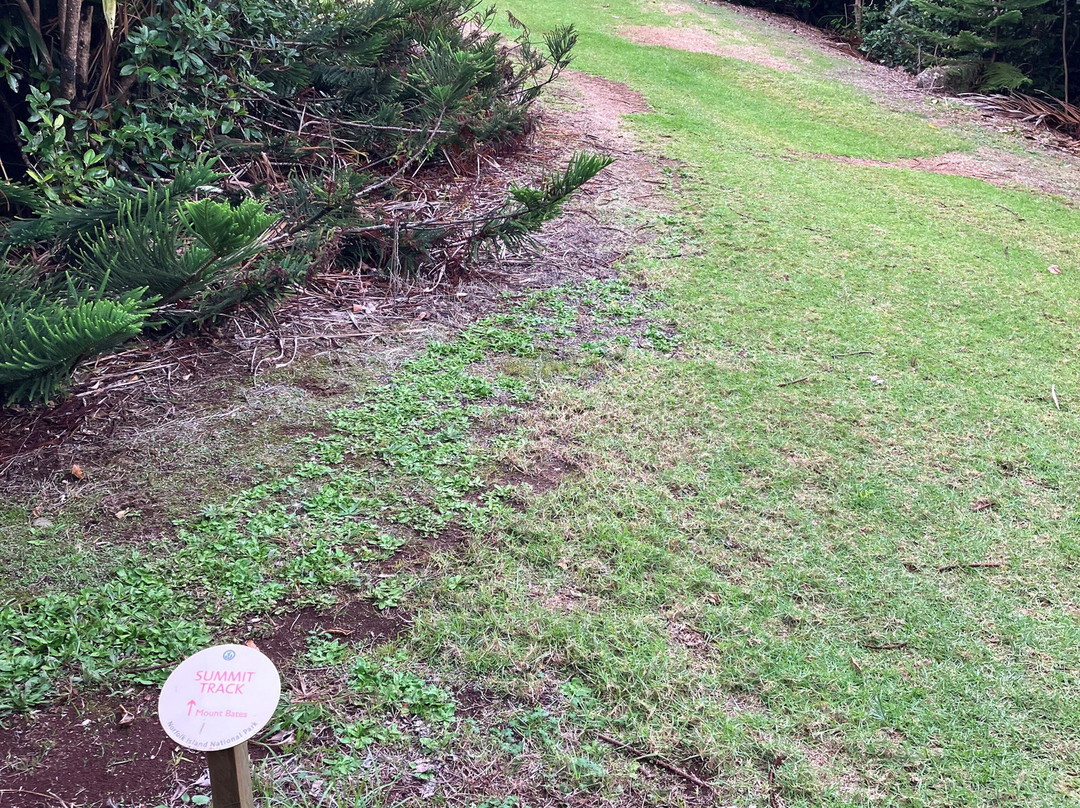
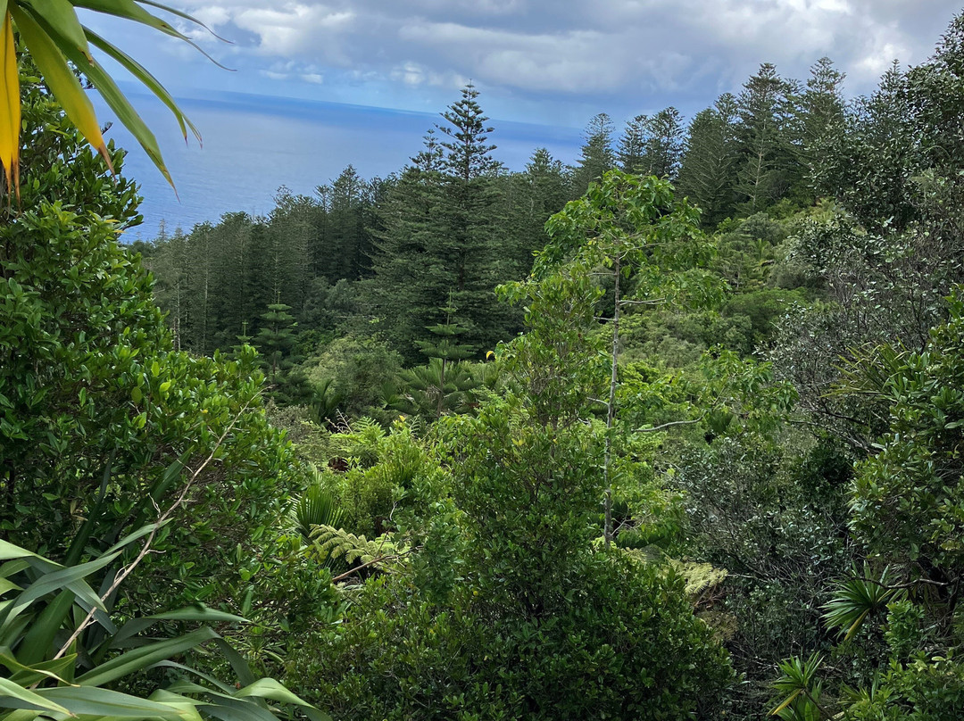
It does not appear that you can drive up to Mount Bates though there are several walking tracks. We took the Summit Track from Mount Pitt which the notice at the start advised that it was a 500 metre easy walk. Whilst we were fine a think less mobile people may struggle as, whilst there are good pathways in some sections, others are just a dirt or grass path with some uphill/downhill sections and approximately 100 steps when you get to the ascent required to get to the top of Mount Bates.
Once at the top there are some lovely views but not as good as Mount Pitt.
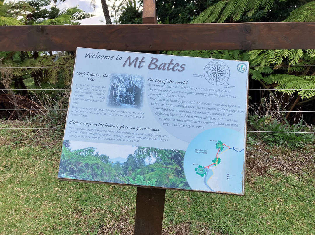
What was of interest at the top was the disused radar bunker and equipment used during WWII.
It does not appear that you can drive up to Mount Bates though there are several walking tracks. We took the Summit Track from Mount Pitt which the notice at the start advised that it was a 500 metre easy walk. Whilst we were fine a think less mobile people may struggle as, whilst there are good pathways in some sections, others are just a dirt or grass path with some uphill/downhill sections and approximately 100 steps when you get to the ascent required to get to the top of Mount Bates.
Once at the top there are some lovely views but not as good as Mount Pitt.
What was of interest at the top was the disused radar bunker and equipment used during WWII.
翻译:贝茨山可能是岛上的最高点,海拔 319 米——比皮特山高一米——但皮特山的景色更好。
虽然有几条步行道,但似乎不能开车上贝茨山。我们从皮特山走山顶步道,一开始的告示说这是一条 500 米的轻松步行道。虽然我们没事,但行动不便的人可能会吃力,因为虽然有些路段有很好的小路,但其他路段只是泥土路或草路,有一些上坡/下坡路段,当你到达贝茨山顶时,需要爬大约 100 个台阶。
一旦到达山顶,就会看到一些美丽的景色,但不如皮特山好。
山顶上有趣的是二战期间使用的废弃雷达掩体和设备。
虽然有几条步行道,但似乎不能开车上贝茨山。我们从皮特山走山顶步道,一开始的告示说这是一条 500 米的轻松步行道。虽然我们没事,但行动不便的人可能会吃力,因为虽然有些路段有很好的小路,但其他路段只是泥土路或草路,有一些上坡/下坡路段,当你到达贝茨山顶时,需要爬大约 100 个台阶。
一旦到达山顶,就会看到一些美丽的景色,但不如皮特山好。
山顶上有趣的是二战期间使用的废弃雷达掩体和设备。


© 2025 Tripadvisor 版权所有。
部分照片由 VFM Leonardo 提供。
TripAdvisor公司对外部网站的内容一概不负责。优惠价格中不含税和其他费用。
ICP证:沪B2-20200433
沪ICP备20013175号
 沪公网安备31010502005427号
鹰程信息技术(上海)有限公司